
|
|
A hint of tropics in the waterLindsay McRoryNovember 17, 1995
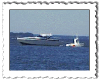
Our next stop was Oriental, North Carolina. It was a bumpy ride. In typical northern intercoastal tradition, larger bodies of water are joined by canals, otherwise known as land cuts. The largest landcut in the region is the Pungo River canal, which brought us into Belhaven. We arrived in Oriental without much excitement, and decided to spend a couple days here waiting on a mail drop. No, there isn't a Chinese restaurant in Oriental. But the area did provide an excellent opportunity to stock up on gear and supplies. Whittaker Creek marina had the best selection I've seen to date of gear, charts, and just about anything else you might want. But everyone seemed to be itching to move south with the good weather. Nights in the low thirties are just too darn cold. So, as soon as the mail was picked up, we cast off and left this nice spot behind. The Adam's Creek canal led us from Oriental to the Beaufort area of North Carolina. Unlike the last two canals, the Adam's Creek canal leads to something new, like opening a curtain to a new room. Gone is the root-beer-colored water, straw brown banks, and the swamp look. The water is clear and things start taking on a more tropical look. Walter Cronkite wrote an article about the Intercoastal for one of the waterway guides and titled it "Navigating the Ribbon of Sunshine." Of all the things we could think of to call the Intercoastal Waterway, "ribbon of sunshine" was not one of them. But once we moved through the Adam's Creek canal into these new waters, we started to change our minds. In most places, the actual channel within the Intercoastal is narrow, even when the waterway spreads wide in the larger, shallow bodies of water. For most sailboats, this restriction on course is not a problem. Most sailboats travel at 5 to 10 mph and have lots of time to verify and reverify their position in the channel. For powerboats, it can be a problem. A fast powerboat traveling at 30 mph or more has less time to verify and react. Most places on the Intercoastal offer no mercy. At times, an error of 30 feet or less will slide a boat into 6 inches of water. While coming out of Adam's Creek we were passed by a 35-foot powerboat planing along at 35 mph. Denise and I noticed that he was taking the markers a little on the wide side. An hour later, we passed him as he was being towed off a mud bank. He passed us again two hours later. Well he didn't really pass us, he buzzed by us within 10 feet at full throttle. He must have been a little embarrassed (or mad) because I took a few photographs of him getting towed off. Two minutes after passing us for the second time he flew right up another shoal. It was a tough one to figure because the 40-foot-wide channel was perfectly straight for miles, and well-marked. But if you figure it out, 35 mph is 51 feet per second, so it would only take a couple of seconds to venture far enough off course to ground. He was having a real bad day. On the other side, the Beaufort boat towing company was thriving.
|
 
 |
 We left Belhaven at 7 a.m. sharp under clear skies and 25 mph
winds. The weather forecast predicted that winds would drop off in the
afternoon, so we were not concerned about a repeat of bad weather.
We left Belhaven at 7 a.m. sharp under clear skies and 25 mph
winds. The weather forecast predicted that winds would drop off in the
afternoon, so we were not concerned about a repeat of bad weather.
